About this video
What Is a 3D Printed City Map?
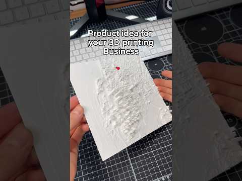
A 3D printed city map is a scaled, physical terrain model that captures the streets, buildings, and topography of a real-world location. Instead of staring at a flat screen, you can hold a miniature version of your hometown, a favorite travel destination, or a future development site right in your hands. These models are popular for architectural visualization, urban planning, classroom learning, and personalized home decor.
How PrintPal Makes It Easy
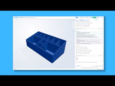
PrintPal offers a free, browser-based tool that converts real-world geography into print-ready 3D models. The workflow is intentionally simple so anyone, from hobbyists to professional designers, can produce a high-quality map without learning CAD software.
Step-by-Step Workflow
- Search or draw your area. Type a city name into the search bar, or click and drag across an interactive map to frame the exact neighborhood, landmark, or region you want to print.
- Adjust the settings. Play with scale, height exaggeration, wall thickness, and base style until the preview matches your vision. PrintPal automatically optimizes the geometry so the file prints cleanly on most FDM and resin printers.
- Export and print. Download the optimized STL file and send it straight to your slicer. No manual mesh repair or scaling math required.
Tips for the Best Results
- Match the scale to your printer. A 6-inch build plate can comfortably handle a small downtown grid, while a larger bed lets you capture an entire suburb or coastline.
- Use a 0.4 mm nozzle with 0.2 mm layer height for a balance of detail and print speed on FDM machines.
- Print in matte PLA or PETG to hide minor layer lines and make elevation changes easier to read.
- Add a thin coat of acrylic paint or a wood filament to turn the map into a striking desk piece or gift.
Frequently Asked Questions
Is the PrintPal map tool really free?
Yes, the basic map generator is free to use. You can search, customize, and export STL files without a subscription.
What file format do I get?
The tool exports an optimized STL file that works with every major slicer, including Cura, PrusaSlicer, and Bambu Studio.
Can I print terrain and buildings together?
Yes. PrintPal combines elevation data with building footprints into a single watertight mesh, so terrain and structures print as one cohesive model.
Which printers work best?
Both FDM and resin printers handle the exported files well. FDM is great for larger city sections, while resin captures the finest architectural detail.